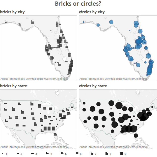
Allan Walker creates Tableau-ready polygons using Richard Leeke’s shapetotab tool from San Francisco’s building footprints, accessible from tableaumapping.bi.
What emerges is the evolving story of San Francisco’s urban environment by color encoding of building height in over 3 million beautiful marks with street-level details.
All in under 3 minutes.
(Source: http://community.tableausoftware.com/)

Recent Comments